Across Continents

Ken's Blog

Southern States

January 20th, 2012

Antonio and Brian were riding west towards California and the Pacific. Ninth day on the road they said. I found this very reassuring, confirming my own timeline to the Florida coast to be a realistic one. Planes to catch. They’d been very spooked by dogs chasing them. I sought to raise spirits by explaining they’d not have the same problem east of Louisiana. Definitely a Southern States thing I added.

We parted company and I returned to riding through gently undulating woodland. Warm, sometimes even feeling a little humid. Tranquil. At a gas station a newspaper headlined with "Stone County quiet in 2011", although directly beneath this was written, in bold red lettering, "D I S A S T E R". I meant to buy a copy but then forgot.

Antonio and Brian had asked how long it’d taken to cross Texas. I’d hesitated briefly. Trying to recall where New Mexico had ended and Texas started. I ventured about three weeks. Rough guess I said. I’d just 650 miles left to the coast. Alabama tomorrow afternoon, Florida the same time the next day. Crossing an entire State in about twenty hour hours. Not that Mississippi or Louisiana had exactly taken long. Days.

obpostlogo

Share

South eastern Alaska

September 26th, 2011

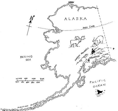
Alaskan map

Conscious that not everyone’s as familiar with the geography of south eastern Alaska as yours truly – nor should you be – a brief resume of the route so far, and the road ahead.

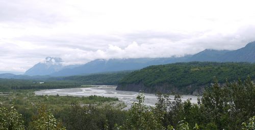
P1060326

From the town of Palmer, a little north of Anchorage, I’ve been following the Glenn Highway eastwards towards Glennallen. The Alaska Range to the north, the Chugach Mountains to the south. Former best known for Mount McKinley, at over twenty thousand feet, the loftiest peak in North America.

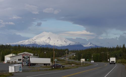
P1060383

Steep sided, wooded valleys have quickly given way to more open ground, tundra. Bleak. Further east, beyond the small town of Glennallen, lies the Wrangell-St Elias National Park. Mount Drum providing a fine backdrop at over twelve thousand snow capped feet.

From Glennallen, the Tok Cut-Off runs north east towards the equally small town of Tok – pronounced Toke – meeting up with the Alaska-Canada Highway – the Alcan. Then south east to the Canadian Border at Beaver Creek in the Yukon Province. About 600 miles all told.

obpostlogo

Share

Around Victoria Peak

January 6th, 2011

Around Victoria Peak from Ken Roberts on Vimeo.

Enjoying a brief foray onto the tourist trail, Ken visits Victoria Peak, the highest point on Hong Kong Island. Offering a brief introduction to the former British colony’s geography, he explores the viewing centre, and avoids the queues for the Peak tram by taking… the Number 15 bus. And look out for the fortunately short clips of communal music making. You have been warned!

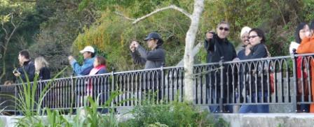
Tourists - web

Share

Lie of the land

December 6th, 2010

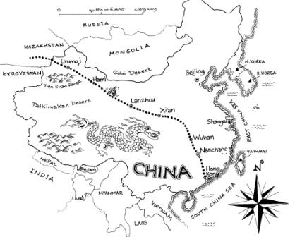
china - web

It’d been suggested a quick refresher might be helpful. China is pretty big. Roughly the size of Europe. But a bit more populated. These days people knew where it was. But less so what lay inside its borders. I’d not been exactly sure myself until I’d arrived.

So. A quick recap. Bit of a teach-in. Divide into four quarters. Bottom left. Bordering India and Nepal. Tibet. Rarified atmosphere. Mountains. Big ones. Cold. Even in summer. Probably.

Top left. Urumqi. First city I’d visited in China after crossing from Kazakhstan. And deserts. Lots of the stuff. Very hot in summer. And bitterly cold in winter. Mostly bleak and barren. Stuff of the Silk Roads. Ancient trading routes running as far as Xi’an.

Top right. Don’t know. Haven’t visited. Too close to North Korea for my liking. Finally, bottom right. I’ll let you know. That’s where I heading next, en route to Hong Kong.

Sweeping generalisations I admit. For, beyond Lanzhou, towards Xi’an and the city of Wuhan, terraced, cultivated hillsides are more the norm. Often at deceptively high altitudes, much of the route above that of the summit of Ben Nevis. No more desert. And Wuhan itself lies on a wide flood plain. Swift riding.

Share
Terms & Conditions of Use | Copyright © 2009-2024 Ken Roberts