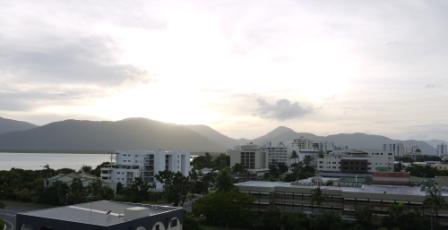
First light in Cairns. Eerie. Awaiting the imminent arrival of Cyclone Yasi. Now upgraded to maximum Category 5. Winds over two hundred miles an hour. It may be a very different scene tomorrow morning..

Five am local. Cairns. Not yet light. Eerie. A few people wandering around. Waiting. Overnight Cyclone Yasi’s predicted track has shifted a little south towards the coastal town of Innisfail. But such is the sheer size of the system – the eye is over sixty miles across – considerable destruction is still expected here. No one is under any illusions about what’s about to happen.
The system is expected to make landfall around midnight tonight, intensifying to maximum Category 5 as it approaches the coast. Its effects being felt long before that. Power grid already down. Emergency generator kicked in.
The last flights out of Cairns have left. The major regional hospital next door evacuated overnight by the Royal Australian Air Force. The big concern remains tidal surge, especially as much of Cairns is built on former mangrove swamp. Some of it below sea level. Possibility of metres of seawater inundating the city.
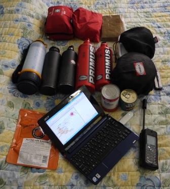
Faced with my travellers hostel being flooded out, I made a snap decision earlier to relocate to a hotel nearby that should be bit safer. Emma and all the kit stowed on the sixth floor. In the windowless bathroom that will be my refuge if things get really tough. Also stocked with a week’s worth of tinned food, water and fuel. For the aftermath.
Plan is to try and capture the events of the next few days as best I can. Cameras charged. Notebook ready. Cyclones are regular occurrences here, but it seems Yasi is a monster. Unknown territory. I’ll be doing my level best to share my first hand experiences via the web – my own website, Facebook and Twitter – as circumstances permit. Contingency plan in place to at least get the odd ’tweet’ out via my satellite phone. It’s going to be emotional. And it’s my birthday…
[Author’s note: You should also see a few other posts appearing each evening, unconnected with Cyclone Yasi, for a couple more days – these are ones I’ve already uploaded onto my UK server and scheduled for publication]

Striking a balance. No panic. Rather, just making sensible preparations for the arrival of Severe Tropical Cyclone Yasi. The hundred kilometre wide eye expected to make landfall along the Queensland coast within the next 48 hours. Off to stock up on tinned food, bottled water, fuel for stove, cash. And a small birthday cake.

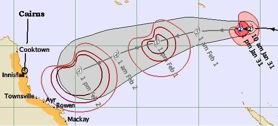
Birthday looming. Some celebrate with jelly and ice cream. Looks like I’m going to share mine with Tropical Cyclone Yasi. Described by Australia’s Bureau of Meteorology as a “Goliath“. Deep joy. Look carefully at the map of the system’s expected track and you’ll notice some small numbers. Indicates strength. Increasing as it approaches the coast. Four isn’t good.
Still, feeling pretty stoic about it all. For several reasons. Firstly, I’m actually quite excited. So far I’ve found myself arriving after the riots, missing the bomb attacks, escaping the flooding. Looks like I might get some first hand experience. Hoping to capture it on film. See how quickly I can get to share it on the web.
Then there’s the Aussie spirit. Talk of Cyclone parties. Batten down the hatches. Get the washing in. Find a safe refuge. First floor is good to avoid being flooded out. Tape up the windows. Grab a beer. Some friends. Watch things fly past. The odd dustbin. Debris. Livestock can be a bit problematic.
And even if my curiosity doesn’t appeal, nor does the “Dunkirk spirit”, there’s the little issue of where exactly would you go? On a bicycle? Cyclones have a habit of being a bit unpredictable. Suddenly veering off the expected track. Best to sit put.
[Image above Copyright Commonwealth of Australia Bureau of Meteorology. For illustrative rather than predictive purposes]